If you are looking for a place to camp with access to hiking, boating, canoeing, and golf and is just minutes away from the amenities of Athabasca, look no further than River Meadows RV Park. River Meadows is a family-run business that developed the site on their property because they knew it was a special place and wanted to share it with others.
River Meadows is 2 hours north of Edmonton and St. Albert and 3 hours south of Ft. McMurray.
All photos by River Meadows RV Park
The Campground
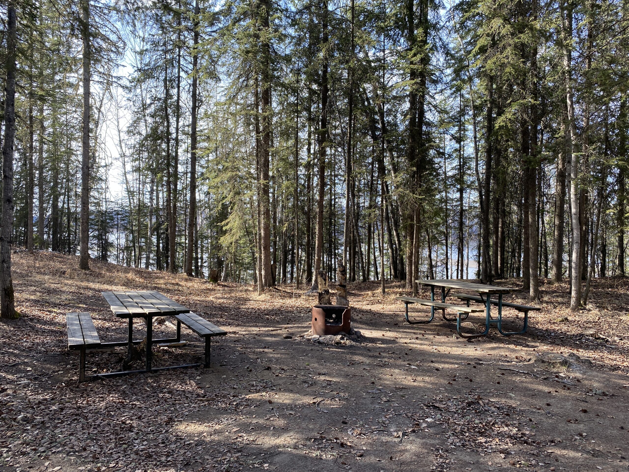
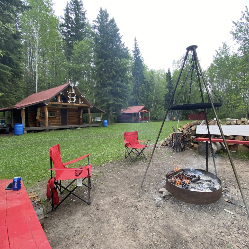
River Meadows RV Park is nestled in the Boreal forest on the banks of the Athabasca River, just a few minutes north of Athabasca. It offers guests generously sized spots for either short-term or seasonal stays. Some sites back into the bush and others have river views. All have fire pits and picnic tables.
While the sites are unserviced, seasonal campers can set up water and sewer tanks. The Athabasca sani dump is just a few minutes away.
A Google reviewer said:
“We spent last summer hanging out here and can’t wait until spring arrives so we can get right back to our favorite spot. This is a place where you can do it all! Quadding, boating, hiking, fishing, foraging, and yet you have everything 10 mins away.”
Athabasca River Access
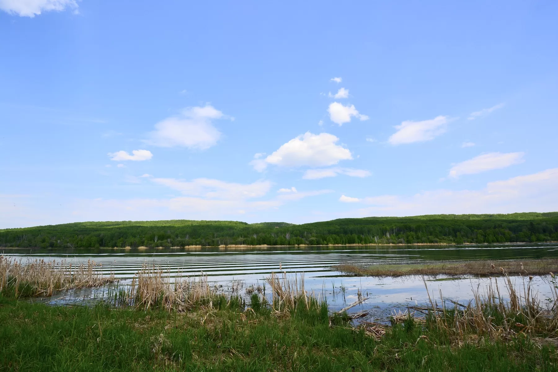
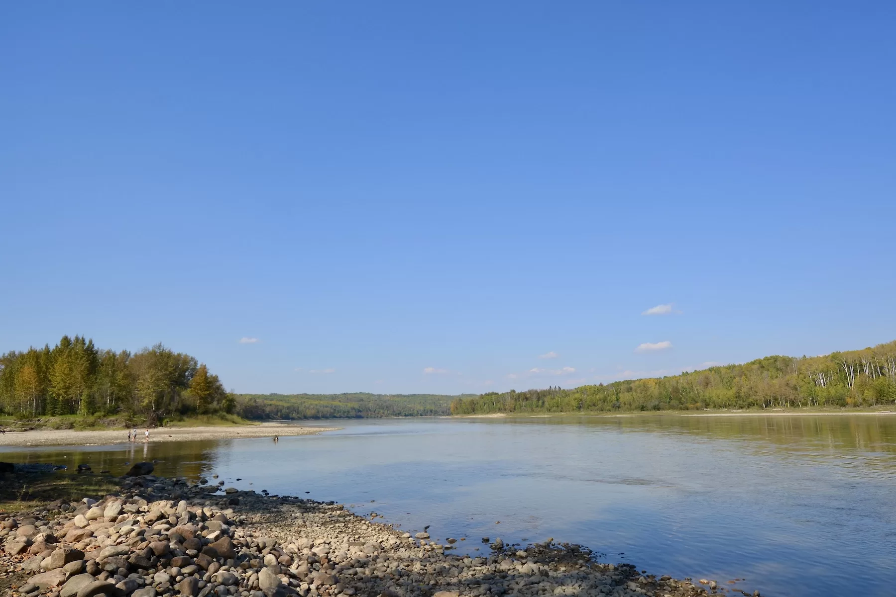
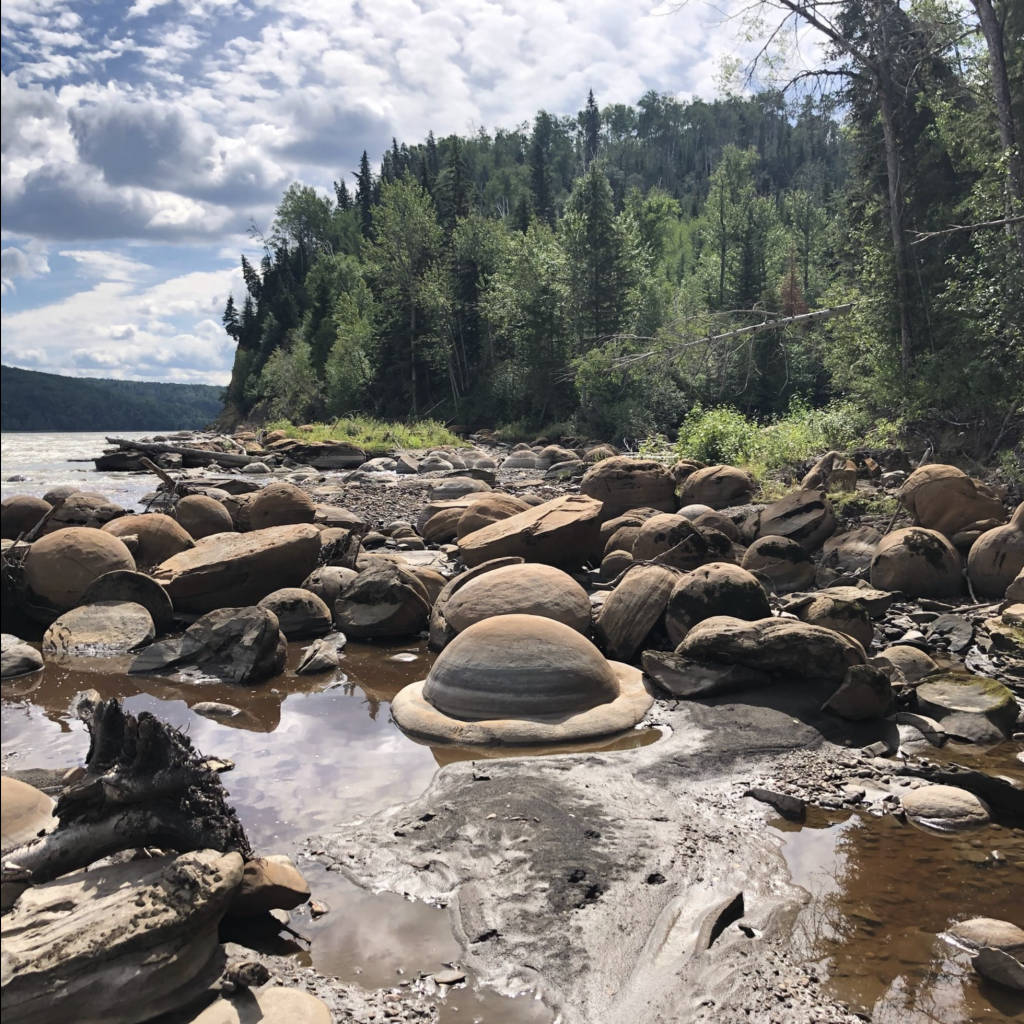
River Meadows offers a great location to enjoy the Athabasca River, in many ways! You can launch your river boat, canoe or kayak for a trip down the river. Or if you are into fishing, there are spots you can fish off of the bank.
They have a day-use area if you’d like to have a picnic and a swim in the channel by the nearby island.
Hiking/Biking Trails
River Meadows also has many trails, set in the forest and along the river. You can hike, run or ride your bike just steps away from your campsite.
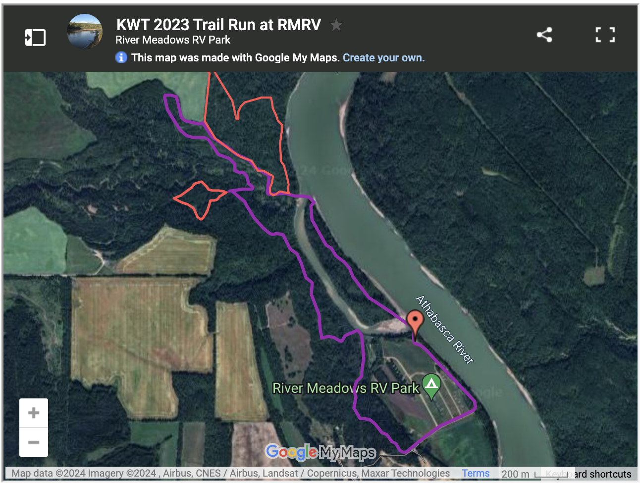
The Kapâwinihk Wilderness Triathalon is a new and exciting annual event hosted at River Meadows. It is a unique event, in that instead of bike/swim/run, triathletes bike/paddle/trail run.
The race begins in the Town of Athabasca where the cyclists start at the Riverfront Park. They make their way through the Muskeg Creek trails and back down to the river. There, they launch from Riverfront Park into the Athabasca River and paddle a few kilometres downstream. When they get to River Meadows, they run the trails through the forest!
The event ends with a barbeque and frosty beer in the green space at River Meadows. It’s a great day for athletes of all levels. Learn more here: www.parallel54.org.
Annual Athabasca Riverboat Association Rally
River Meadows also participates in the annual Jet Boat Rally, running from Athabasca, downriver to the Riverside Recreation Area (Learn more: www.facebook.com/jetboattheathabasca). River Meadows offers a stop where boaters can grab some BBQ lunch and pick up a card for the poker run.
The Athabasca Region is nestled in the southern part of the mixed-wood boreal forest, providing excellent habitat for birds, mammals, amphibians, insects and more! This creates great opportunities for wildlife spotting, photography and viewing. Each season there is a varied cast of characters for you to see. Spring is a great time for returning migratory birds.
The Athabasca Region has viewing platforms and other infrastructure to help make your wildlife watching easier. All of the routes have ample camping spots, so you can take your time to tour all of the sites. So bring your binoculars or telephoto lens to glimpse some of the iconic species in the Athabasca Region! #LiveLifeOutside
Here are some routes to help you plan a wildlife-viewing adventure…
Tips for Successful Wildlife Viewing
The wildlife you might see depends on the seasons. Some birds may live here all year and others migrate here.
Some of these sites are more remote and may not be accessible by all people. Many viewing platforms have ramps, but getting to them may be a challenge.
Many roads are gravel, so be prepared for the driving conditions.
Don’t feed or harass wildlife and stay a safe distance away.
Keep your pet leashed. Dogs can scare wildlife.
Dress for the weather. Layers are best in our climate!
Be respectful of the habitat and leave no trace.
Have fun!
Here are some guides produced by Crooked Creek Conservancy and partners. They have some basic maps, lists of species and details on when and where to best view them.
A great wildlife-watching day trip or overnight from Edmonton!
Leave from Edmonton or St. Albert and drive north on Hwy 2 to Rochester. Turn into Rochester and follow Range Road 240A north out of the village. The viewpoint is about 7 km north. There is a sign to mark the entrance.
From there make your way north-west to Narrow Lake Campground. Travel north to Perryvale and get back onto Hwy 2. Travel north to Hwy 663 and turn west. Follow to TWP 650 (its a bit of a jig and a jag, so consult your maps). Follow west then forth to the campground. There are tables and fire-pits in the day-use area and this would make a good spot to view, as it is adjacent to some riparian areas where birds and wildlife might hang out.
Depending on how long you want to spend, from here you could visit Cross Lake Provincial Park or head north to Baptiste Lake. Cross Lake has a viewing platform that is a bit of a hike in, but is an undisturbed area so viewing might be good!
To get to the Baptiste Lake Campground, take TWP 652 east to Hwy 812 and head north. This will take you to Baptiste Lake. Turn west to Baptiste Lake and follow Baptiste Dr. to the campground. When you arrive at the Baptiste Lake Campground, follow the road north a bit and you will see some picnic tables along the bank. This area is a little more secluded and away from the busy beach area.
When you are finished at Baptiste, head east on Hwy 2 to Athabasca for a delicious meal at one of our great restaurants or stay overnight. From Athabasca, it’s just 1.5 hours back to Edmonton.
Tawatinaw River Viewpoint
Narrow Lake
Baptiste Lake Day Use Area
North of Athabasca
North of Athabasca there are some opportunities to do some viewing right on the Athabasca River and then at Calling Lake Provincial Park.
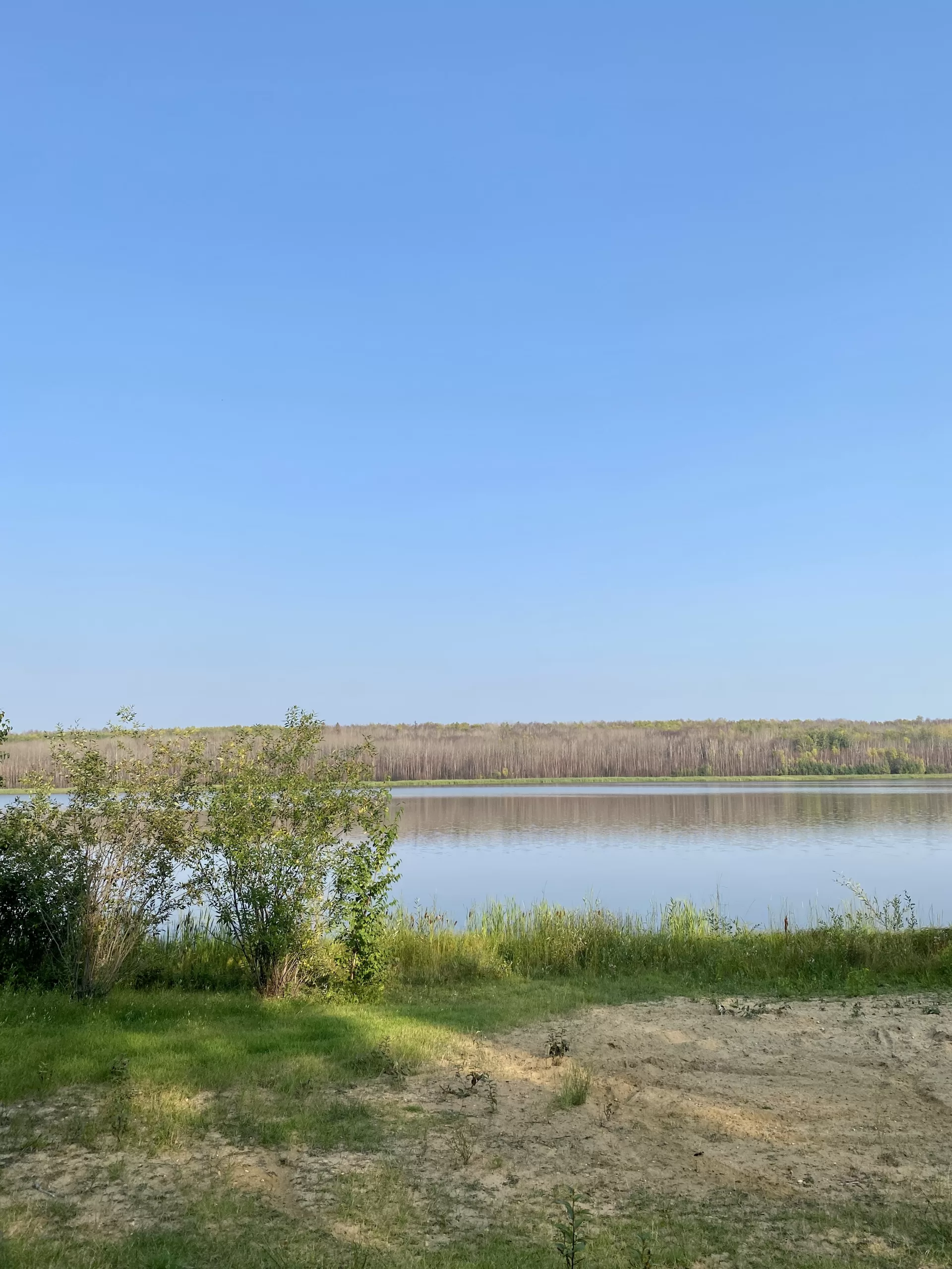
Travel north from Athabasca on Highway 813. The first place to access the river on this route is River Meadows RV Park. They are a private RV park but have a day-use area right on the river bank. Their site is also adjacent to a meander that might be a great spot to view all sorts of wildlife. If you want to stop in for the day, please contact them here. Or better yet, if you are combining your wildlife viewing with camping, stay the night!
From there you can return to Highway 813 and follow it to Riverside Recreation Park. Turn east on Twp Rd 684. Turn right on Range Road 214 and continue until you reach the campground. There is access to the river, a day-use area and camping.
From there return to Highway 813 and follow it north to Calling Lake Provincial Park Campground. There are a few secluded spots along the lake bank where some birds and other wildlife might be hanging out.
Northwest of Athabasca
This route is a longer day trip from Edmonton or Athabasca. There are plenty of camping or lodging opportunities if you want to stay overnight.
From Athabasca, follow Highway 2 West then north. Turn east on TWP road 673 and follow to RR235. Head north to TWP road 680. Turn east and follow to the campground. Island Lake has a viewing platform that is a short hike from the campground.
From there, make your way back to RR 235 and turn north. Travel a few kilometres until you get to TWP road 682 and turn east. Travel east to RR 234 and travel north to the Chain Lakes Provincial Recreation Area Campground. Chain Lakes has an open beach for birdwatching and provides self-registration campsites.
From Chain Lakes PRA, head back down to TWP 682 and travel west until you get to Hwy 2. Turn north and travel 15 km to the Lawrence Lake Provincial Recreation area. The campsite is just off the highway. There is a day-use area where you can set up.
Island Lake Campground
Boyle – East Athabasca County
The Boyle area offers multiple birdwatching opportunities and wildlife spotting. Much of this area is connected to a large section of undisturbed Boreal forest. There are also a varied selection of camping opportunities.
Travel north from Edmonton to Waskatenau. Just before Waskatenau, turn north onto Hwy 831 at the traffic circle. Follow Hwy 831 to Long Lake Provincial Park. Turn east on TWP 631A and follow to the campground. Two sections of the campground offer birdwatching opportunities. There is a day-use and beach area in the north section and a smaller dock and beach section in the south section.
The trailhead leading to the White Earth Valley Natural Area is at the far south end of the south section. Along the trail, there are multiple spots to set up for your bird and wildlife viewing experience.
From Long Lake/White Earth, head back to Hwy 831 and travel north towards Boyle. After stopping for refreshments at Boyle, travel north on Hwy 63 to TWP 654 and follow the signs to Hope Lake Campground.
Hope Lake offers a beach and dock area for observation and an extensive trail system that follows the lake. There are many riparian areas where you will find birds and wildlife.
From Hope Lake, head back to Hwy 63 and travel north a short distance to TWP 662. Follow the signage to North Buck Lake Narrows Campground. This campground had a birdwatching platform that overlooks a narrowing with a lot of wildlife-friendly vegetation.
If you plan on making more of an overnight or multi-day trip, you could continue north on Hwy 63, turn west on Hwy 55 and head to Poacher’s Landing. Turn west on Hwy 55 and follow a short distance to RR 194 A, which leads to the Alberta Pacific pulp mill. Foll north to TWP 690 and turn east. Follow a short distance to the Poacher’s Landing entrance. When you get to the park sign, take the left road to the campsite. Poacher’s Landing has a day-use area and 6 first-come first-serve campsites. From the boat launch area, you’ll see several islands in the river that are home to many birds.
If you travel from Fort McMurray, follow this route in the opposite order!
Long Lake Provincial Park/White Earth Valley Natural Area
Hope Lake Campground
Poacher’s Landing
Share Your Photos
Whichever route you choose, we hope you get some great photos! Share on social media with the hashtag #VisitTheAthabascaRegion! If you have any questions, contact us here.
Spring is here, so it’s time to start planning your camping trips for 2024! If you’re looking to experience a Boreal getaway, take a look at the Athabasca Region!
The Athabasca Region is rich in camping opportunities for all tastes and skill sets. From fully serviced provincial campgrounds to RV parks to backcountry wilderness, you will find a special place to camp! There are more campgrounds than there are weekends in the summer!
Most camping opportunities now have online booking, so click the provided links to secure your spot. Most Athabasca Region campgrounds are open until the end of September, so take advantage of the amazing fall colours and generally mild weather.
When camping in the Athabasca Region, be sure to note weather conditions and fire bans and always have bear smart food storage. If you are using a watercraft, please clean it before and after use to prevent the spread of invasive species. If you use an ATV remember to keep your wheels out of water and stay on designated trails.
Long Lake Provincial Park
Provincial Campgrounds
Provincial campgrounds in the Athabasca region vary in size and amenities. All have lake access, except Poacher’s Landing, which provides access to the Athabasca River. While most have water available, please bring potable drinking water. Some sites sell firewood.
The Region’s provincial parks are from 1.75 to 2.5 hours from Edmonton and 2.5 to 3 hours from Ft. McMurray.
Boat launch into the Athabasca River and connected to the LaBiche River Wildland
Trails for hiking, ATVs and horses, unserviced lots and first come/first serve
Jackfish Lake Campground
Athabasca County Campgrounds
Athabasca County manages 9 campgrounds throughout the region. Set in the Boreal forest, all are on lakes and have access to the water. Some are as small as 3 campsites with basic amenities, while Forfar Recreation Park has 72 sites and more amenities. All County sites can be reserved online. Firewood is available at some sites, and others close by. Get supplies in Boyle or Athabasca, and take in one of the many events happening throughout the spring, summer and fall camping seasons.
There are seasonal sites available at Hope Lake and Forfar Recreational Area. Fill out an application before Jan 31st of the upcoming camping year and pay a non-refundable $50 fee to apply. You can find more information and the application at the County website: athabascacounty.com/seasonal-camping
Athabasca County campgrounds are around 2 to 2.5 hours from Edmonton and 3 to 3.5 hours from Ft. McMurray.
Great bird and wildlife watching on the birdwatching platform
River Meadows RV Park
Private Campgrounds and RV Parks
Mostly catering to seasonal RV campers, the Athabasca Region has several private campgrounds. Some are adjacent to other recreational offerings including golf, disc golf (fling and footgolf, too), hiking, water access, and more. Some of these private operators offer online booking on their websites. Be sure to check the links for more information and rates.
Fully serviced campsites and shower/laundry facilities
Close to quadding trails and Baptiste Lake water access
Back Country Camping/Wilderness Areas
If you’re looking for your next great adventure, check out the backcountry camping in the Athabasca Regions wilderness areas! Experience the boreal forest up close and personal in some untouched forest areas.
These areas have limited amenities and are set in boreal forest areas including wetlands, small lakes and wildlife. Some areas may have limited cell coverage. Use caution during hunting and fire seasons. Many trails are ATV-friendly, but please stay on the provided trails to preserve our amazing forested areas.
Has some informal campsites with toilet facilities
Blueberry Hill RV Park
More Info
Sani-Dumps
Blueberry Hill, Forfar, Long Lake Provincial Park and Cross Lake Provincial Park have sani-dumps. Most private and provincial sites are for guest use only. Contact your host for details.
You can purchase firewood in multiple places in the County or Athabasca. Click here for listings. Many local gas stations and hardware stores sell bundled firewood.
Enjoy Your Trip
Whether you choose to RV or hike into the wilderness, you’ll experience the Boreal forest, lakes, rivers, wildlife and people of the region at their finest! You’ll want to return for your next camping getaway, and bring your friends too!
To make sure you enjoy your trip to the maximum, be sure to bring appropriate gear and supplies, make a plan and plan to have fun. If you have any questions about camping in the Athabasca Region, email ted@athabascacounty.com
Share your Athabasca Region camping experience on social media using the hashtags #LiveLifeOutside and #VisitTheAthabascaRegion.
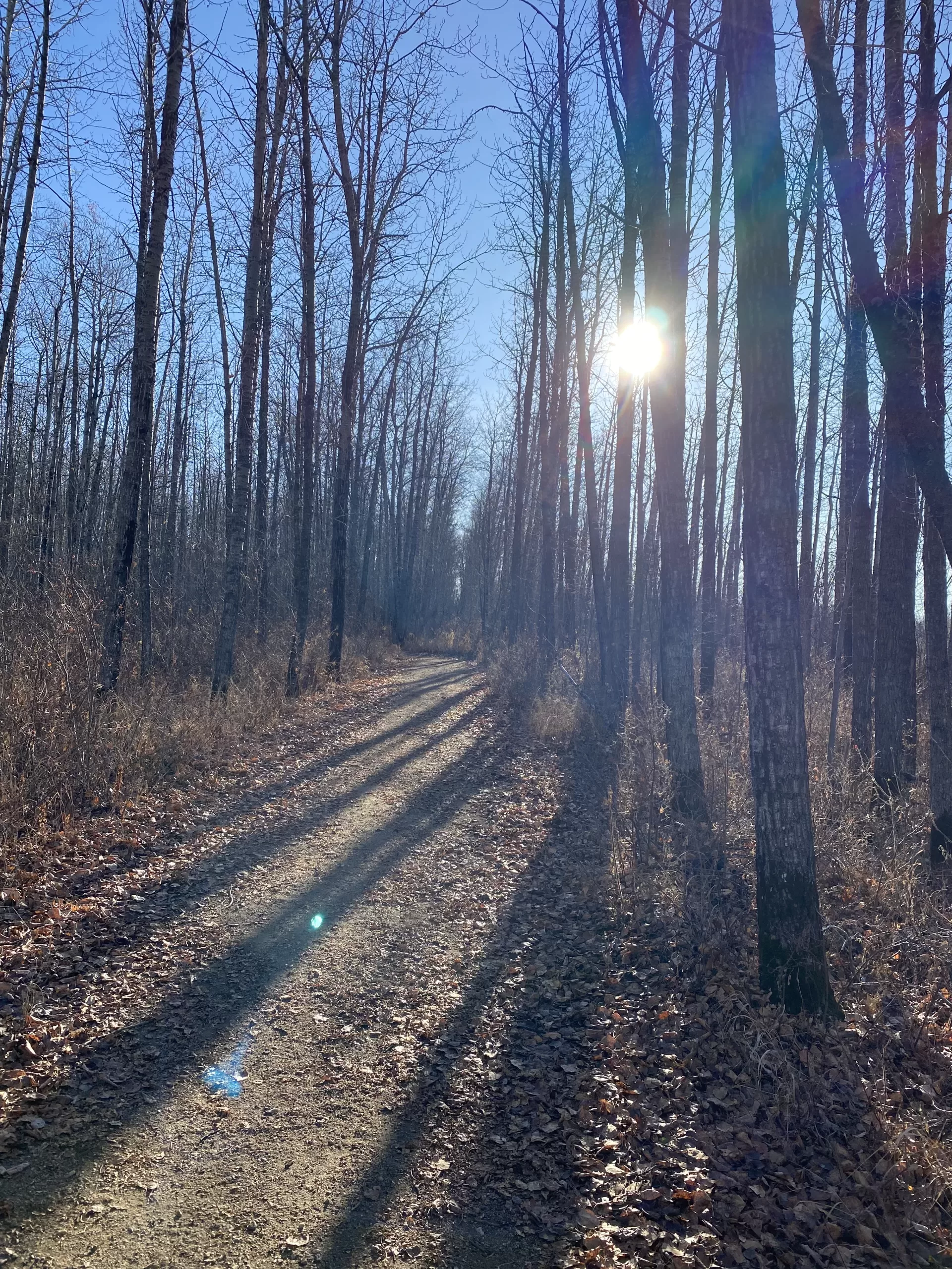
For some, the chilly weather makes them curl up under a blanket and stay cozy until spring. If you’re the opposite, and the brisk air makes you want to get outside and move, then the Athabasca region has some great outdoor walks that can be done in the winter!
If it snows a lot, most of these walks are well-maintained sidewalks, so no trudging. On the nature trails, grab some snowshoes or cross-country skis and move across the land and snow that way.
If you use AllTrails, check out the Athabasca region maps and contribute your own walk/run/ski to add to the route listings. We have added some AllTrail links to the article.
Whatever walk you choose (or walks, because how can you choose just one?), you’ll see how easy it is to enjoy the outdoors and experience an active getaway for the day, weekend or week in the Athabasca Region! #LiveLifeOutside
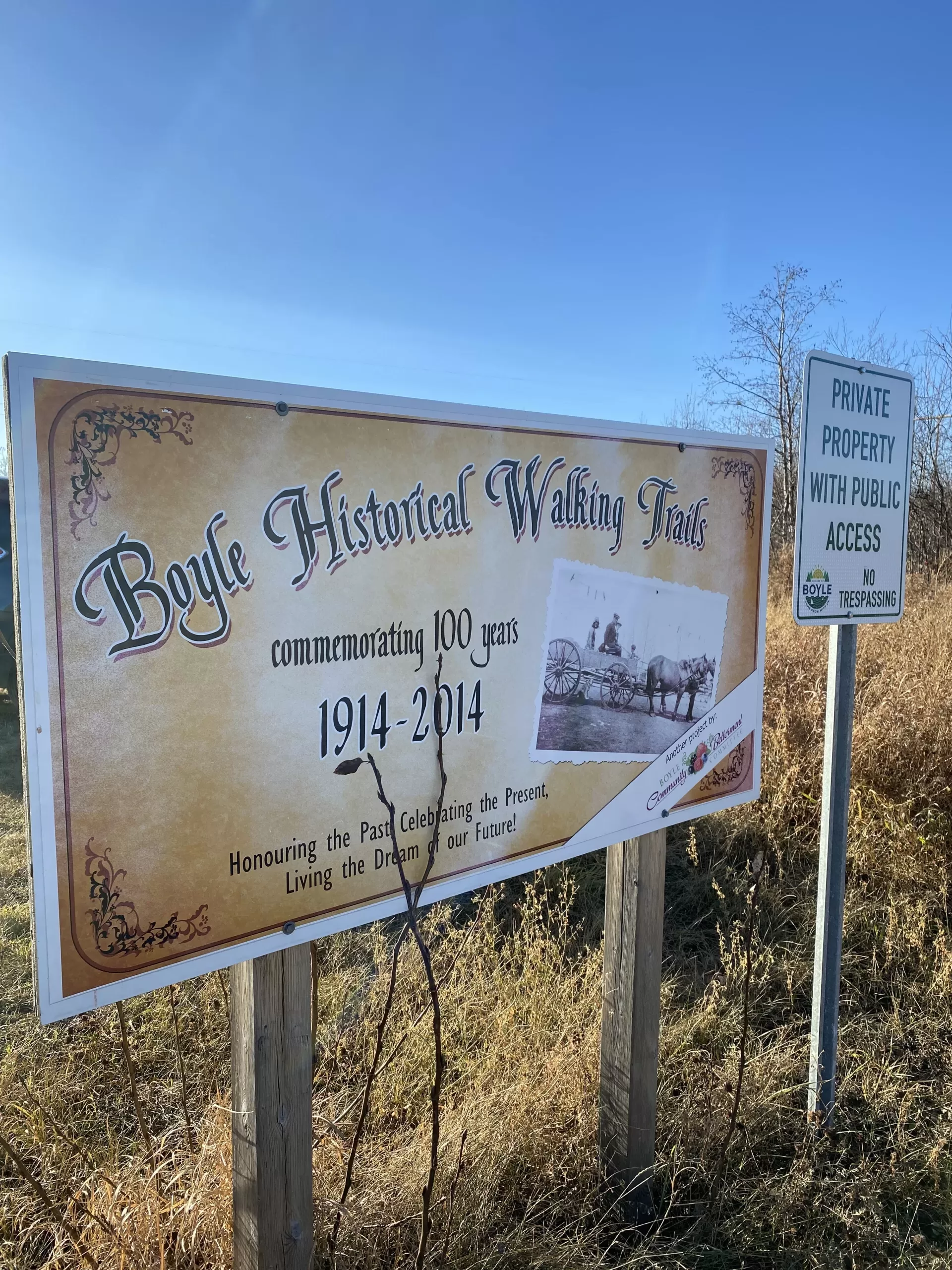
1. Boyle Historical Walk
On the outskirts of the Village of Boyle, you’ll find the Boyle Historical Walking Trails. The trail system was established by the Boyle Community Betterment Committee to commemorate the centennial of the village.
Starting at the Boyle Campground, follow the trail to the west. You can then turn south and then back down to town.
Boyle is 3 hours from Fort McMurray and 1 hour 40 minutes from Edmonton. If you want to stay overnight, check out the accommodations: Airbnb, and Boyle Hotels.
2. Athabasca Rotary Trail
The Athabasca Rotary Trail is a paved walking trail that takes you from one end of Athabasca right to the Muskeg Creek Trail system. If you started on the east end of Athabasca, you could follow the trail down the hill, under the HWY 55 bridge, west along the riverfront until you get to Hwy 55 again. You could continue to the west and meet up with the Muskeg Trail System.
There are informational signs, telling the story of the Athabasca River and Athabasca Landing. There is a great view of the Old Bridge in the distance.
The Riverfront walk is about 2.5 km long, relatively flat and fully paved. The Riverfront Park has firepits to warm up with, with firewood for sale at the Husky Market across the highway.
The Rotary trail is cleared by the Town after a snowfall.
The Town of Athabasca played an important role in the history of Northern Alberta. Athabasca Landing was a transportation hub connecting Edmonton and northern settlements. The river was the highway the town the gathering area.
Many of the historical buildings and sites remain in the town and the Athabasca Historical Society created a historical walk to tell their stories.
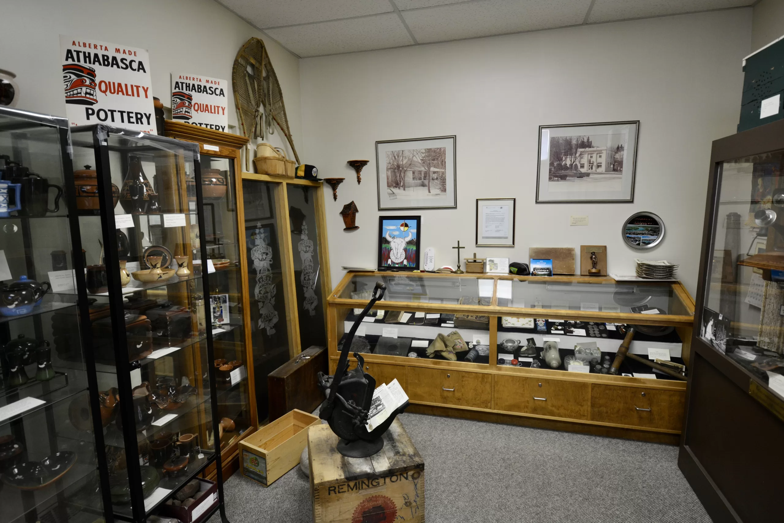
The walk wanders through Downtown Athabasca, down to the Riverfront and back. End your walk with a visit to the extensive collection at the Athabasca Archives.
The sidewalks on this walk are generally cleared after a snowfall.
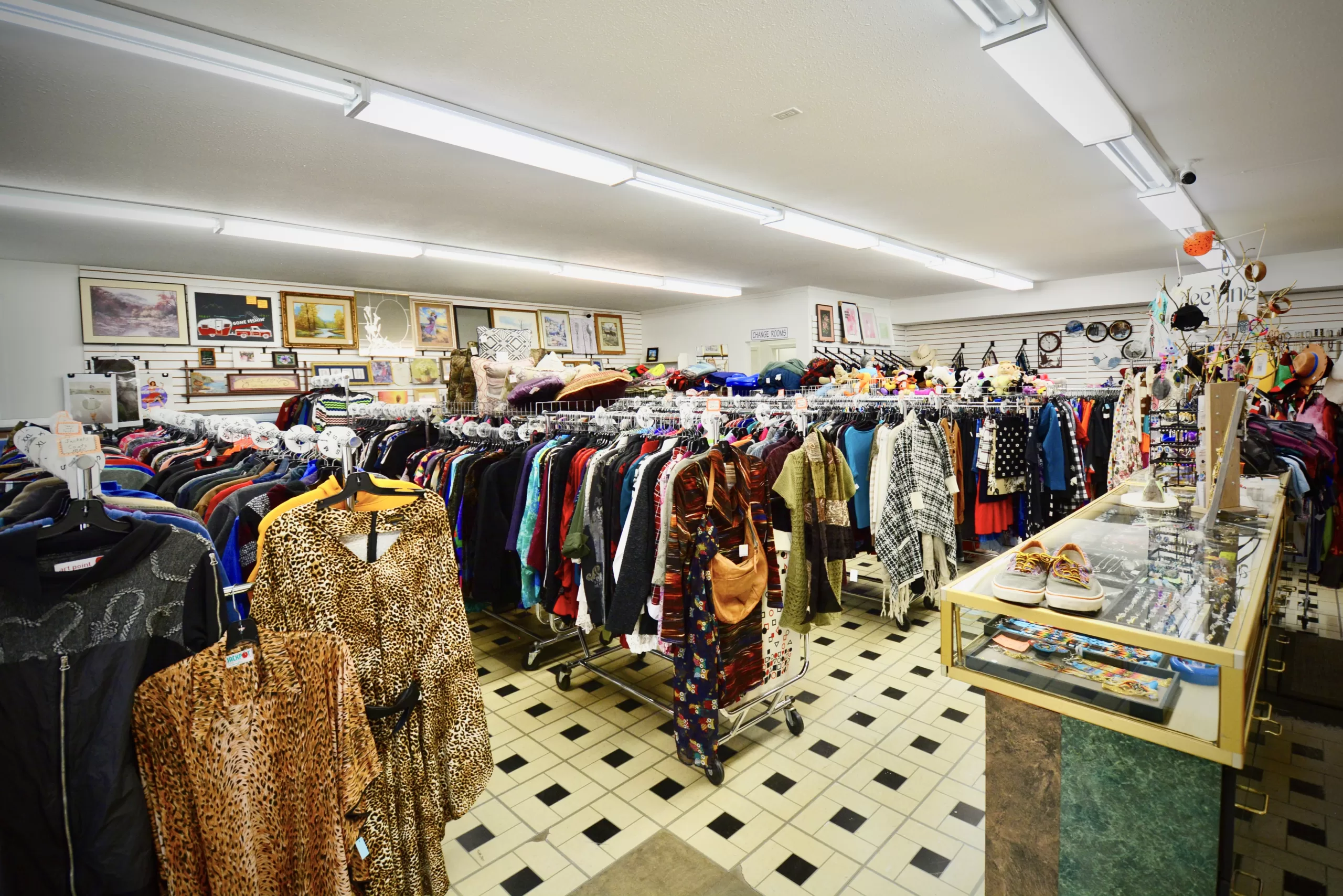
4. Athabasca Thrift & Finds Crawl
Love thrifting, unique finds and a good walk? Then the Athabasca Thrift and Finds crawl is for you!
This walk visits the excellent thrift stores Athabasca hosts, with high quality and unique second-hand finds. You’ll also visit some unique boutiques that curate eclectic and thoughtful collections.
There are plenty of stops for snacks, meals or coffee, so take your time and refresh yourself during your exciting haul!!!
The sidewalks on this walk are generally cleared after a snowfall.
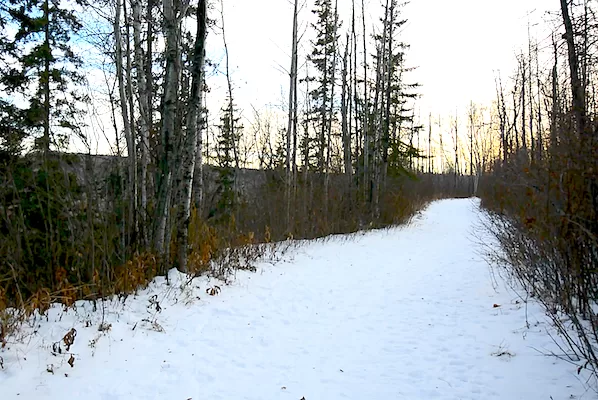
5. Muskeg Creek Trails
One of the best attractions in the Town of Athabasca is the Muskeg Creek Park trail system! The park is located on the west side of Athabasca, adjacent to the University of Athabasca campus. It is a beautiful slice of the Boreal Forest, within the Town of Athabasca.
There are multiple loops of varying distances and elevations.
“The Muskeg Creek Valley is a steep-sided, heavily wooded ravine located west of the downtown area and adjacent to Athabasca University. Covering an area of 17.5 square kilometres with an elevation change of 50 meters, it is easy to get away from the sights and sounds of the nearby urban area.”
In the winter, the trail system is groomed for in-line and skate cross-country skiing. You can rent snowshoes from the Athabasca Regional Multiplex, as well.
The Athabasca Landing/Trans Canada Trail is a historical travel route that followed the Tawatinaw River Valley from Edmonton in the 1800’s.
The trailhead is situated right in the Town of Athabasca, with easy access from Hwy 55 and plenty of parking. This is an in & out trail that can be followed all the way to the Village of Colinton. You can also park at the trailhead in Colinton. The point-to-point distance is approx 13 km.
This trail is not groomed in the winter. Some sections may become packed, but snowshoes or skis are recommended. Bridge repair is ongoing and may be unpassable.
7. Centennial Park – North Shore of Athabasca River
When you look across the Athabasca River from Riverfront Park, you will see a big welcome sign on the north shore. The sign, and an amazing view of the Town of Athabasca, can be found at Athabasca Centennial Park. The also serves as a starting point for a walk along the river and into the forest.
Walk west of the park along the River Ave trail. You can turn and walk north for about another 1 km. The total distance is about 3 km.
This is an in-and-out trail that is not groomed in the winter.
Bonus Walk!
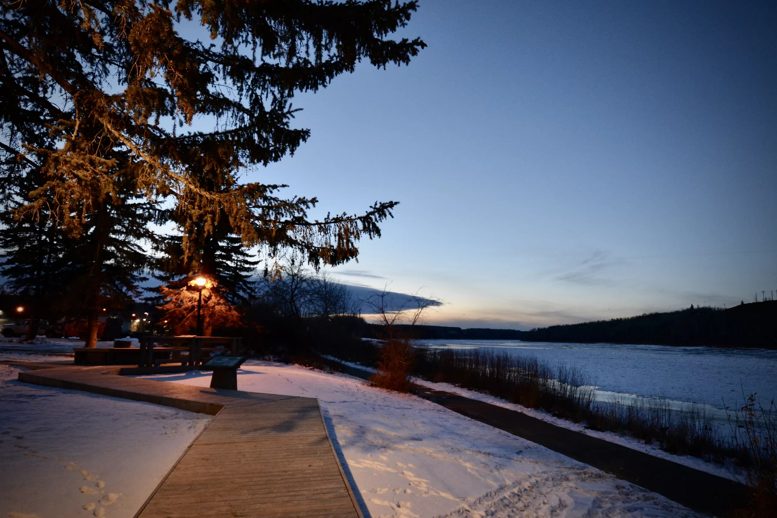
Would you like to experience the terrain that the triathletes participating in the Kapâwinihk Wilderness Triathlon run/walk? It’s a winding trail through gorgeous Boreal forest that has some great views of the Athabasca River. The trail system is part of the River Meadows RV Park but is open to the public. The owners ask that you call or text 780-689-1565 to let them know you are on the property.
Before you enter the RV park, you will see a parking area across from a construction site. The entrance to the trails is just down from there. If you plan on hiking the whole loop, please be aware that two sections cross water, so use caution.
Food and Accommodations in Athabasca
Athabasca has some fantastic restaurants that will serve up a delicious meal to fuel up your walk or warm you up when you are done. If you want to spend a weekend or more, you could choose from chain hotels, Mom & Pop motels and short-term rentals.
The Athabasca region is uniquely situated on the Alberta Boreal forest’s lower edge and bisected by the Athabasca River. There are many areas that boast untouched forests, pristine lakes, abundant wildlife and other natural features that offer travellers a taste of the Alberta wilderness.
Just an hour and a half north of Edmonton and 4.5 hours from Calgary, the Athabasca region makes for an easy wilderness getaway for all skill levels. Let’s take a look at some of the possibilities…
Grand Rapids Wilderness Adventures
One of the premiere wilderness experiences in the Athabasca region is heading down the Athabasca River by jet boat to the Grand Rapids Wilderness Adventures lodge. Your hosts, Darcy and Shirley Zelman will show you the rarely visited natural and historic sites on this stretch of the Athabasca River.
You’ll meet up in the town of Athabasca and travel for approximately 5 hours downriver, stopping to check out multiple sites. The first stop is an area with real old-growth forests where some of the trees are hundreds of years old and so big you can’t wrap your arms around them.
Next, you’ll stop to check out an abandoned Hudson’s Bay trading post. There are a lot of relics left behind displaying the history of the Athabasca River being an important transportation route in early Canada.
Don’t be surprised if there are stops to view the Boreal species that inhabit the area like wolves, bears, moose, deer and raptors to name a few, as the river valley has abundant and varied wildlife.
Your hosts will set you up in a cozy cabin and provide delicious meals to keep you energized for your adventure. You’ll be kept busy with opportunities to fish on the river or paddle around in a canoe.
One of the best features of this trip is the Grand Rapids themselves. A unique geological occurrence created these rapids:
The rapids are a result of river erosion of the 110-million-year-old sandstone of the Grand Rapids Formation. This formation, which forms the large, nearly vertical outcrop on the east side of the valley, is divided into three major sandstone layers. The lowermost level creates the rapids because it is filled with large, two-to-three-metre wide concretions that often contain pieces of petrified logs. These concretions were formed in a similar fashion to those at Red Rock Coulee. As the river erodes away the sand matrix, these huge concretions come loose and dam the river bed. – A Traveller’s Guide to Geological Wonders in Alberta by Ron Mussieux and Marilyn Nelson
GRWA offers a variety of packages. Be sure to book early, as this exclusive adventure fills up quickly.
Check out the videos produced by “Let’s Go Outdoors” on their experience with Grand Rapids Wilderness Adventures:
Just to the northeast of the town of Athabasca lies the La Biche River Wildland. This pristine natural area is only accessible through Poachers Landing.
There are over 17,000 hectares of undisturbed Boreal forest:
La Biche River Wildland Park protects an undisturbed native boreal forest landscape that consists of wetlands and dense forests of poplar, aspen, spruce, birch and fir. The area provides habitat for black bears, lynxes, wolverines, woodland caribou, moose and beaver. – Alberta Parks
There are no formal campgrounds here, other than at Poachers Landing, but backcountry camping is allowed all year long. Other activities include OHV use (please stay on trails to protect this sensitive area), horseback riding, hiking, boating, snowshoeing and more. Special permits are required for fishing, hunting, guiding and other activities.
The Poacher’s Landing campground has 6 unserviced sites and is a first come, first served campsite. There is a boat launch into the Athabasca River, a cookhouse and restrooms. It opens on May 20 and closes on September 20.
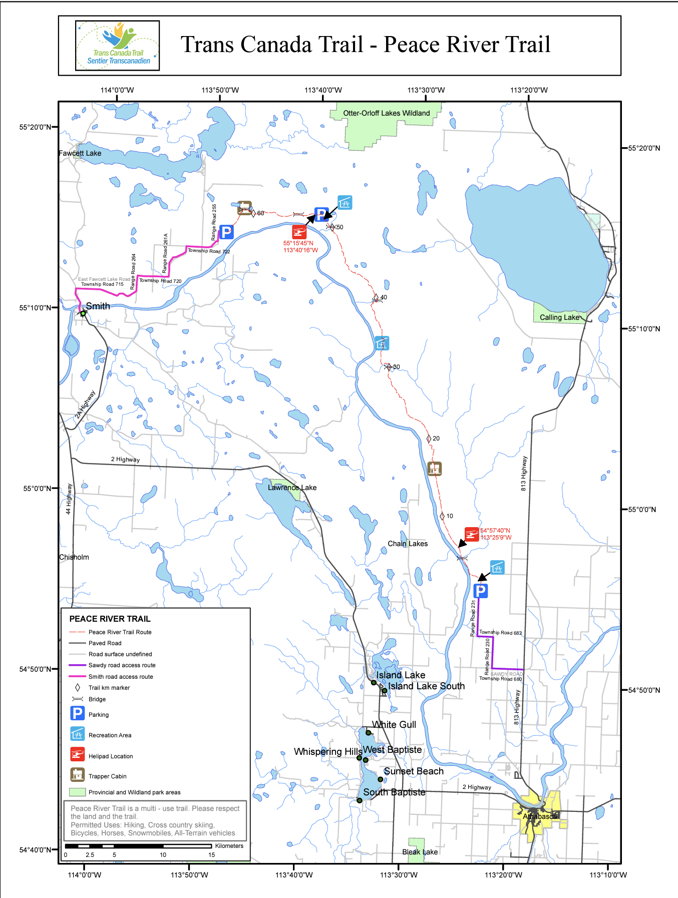
Part of the Trans Canada Trail includes the Peace River Wilderness trail that runs from just north of Athabasca to northeast of Smith, AB. This route was first used by the Indigenous peoples of the area. With the advance of colonial traders, settlers and the gold rush, Euro-Canadian explorers used this trail as a route north.
Spectacular wilderness area with interesting native flora and fauna and views of the Athabasca River. Moose, elk, deer, wolves, black bears and most boreal mammals are abundant. Bald eagles and other raptors make their permanent home in this area. The trail itself was part of one of the principal routes attempted by gold seekers headed to the Klondike in 1898-99 and was a primary settlement path followed by pioneering farming families to the Peace River country until approximately 1920 when it was superseded by the railway. Remnant historical sites located along the trail include gravesites and the Tomato Creek stopping house (developed by the Goodwins in 1910), portrayed in the movie, “Silence of the North.” – http://www.albertatrailnet.com/
The trail follows the Athabasca River through some old-growth Boreal forest. Expect wildlife like bears, wolves, moose, deer, and other Boreal species. It is approximately 60 km from trailhead to trailhead. Permitted uses include hiking, cross-country skiing, bicycles, horses, snowmobiles, and all-terrain vehicles.
The southern trailhead is approximately 30 km north of the Town of Athabasca. There is some parking at each trailhead, and there are three unserviced campsites along the route. Please pack out all garbage and stay on the marked trail. Be bear smart when storing food.
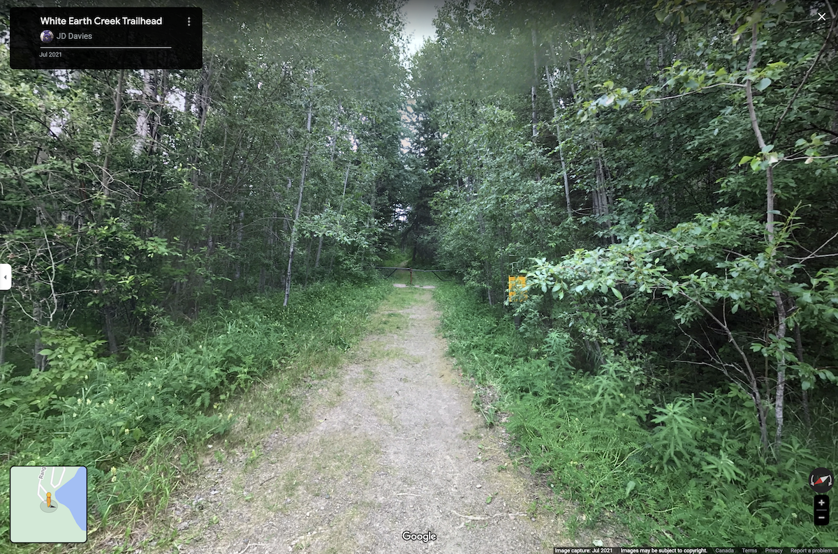
If back-country camping isn’t your speed, the White Earth Natural Area provides a Boreal wilderness experience with the comfort of a campground nearby in Long Lake Provincial Park. It is located about 110 km north of Edmonton on Highway 831, which is accessible from Highway 63 North. It’s about 20 km south of the village of Boyle, where you can stock up on supplies.
The White Earth Trail is 17 km long. The path winds through a wide variety of rich habitats, where an abundance of diverse plants and wildlife thrive. It’s accessible from adjacent Long Lake Provincial Park during operating season (May to October), with parking at the trailhead. The trail can also be accessed year-round from Township Road 621 at the southern end of the Natural Area. – Alberta Parks
The White Earth Valley NA is adjacent to thousands of hectares of undisturbed Boreal forest which promotes great habitat for many Boreal species, including bears and wolves. Use caution around wildlife and be bear-smart with food storage.
The Hubert Lake Wildland Provincial Park is about an hour southwest of Athabasca and about 2 hours northwest of Edmonton. The Hubert Lake WPP offers kilometres of trails through a central mixed-wood boreal landscape. The Athabasca River is on the west border and the Pembina River is on the east.
Hubert Lake Wildland Park consists of a sand dune complex and numerous small lakes and wetlands. Jack pine is the dominant tree species on the dunes. Itervening depressions support black spruce and larch, with open fens in wetter areas. The park is an important nesting area for great blue herons and sandhill cranes. A small caribou herd wanders in and out of the park.
Backcountry camping is allowed, with two unofficial sites on the map. OHVs are permitted on designated trails only. Off-trail use is prohibited.
The Otter-Orloff Lakes Wildland Provincial Park is about an hour north of Athabasca, 2.5 hours north of Edmonton and 3 hours southwest of Fort McMurray.
The “road” to Orloff Lake only goes a portion of the way. In dry weather, this road is good but dead ends near Rock Island Forestry Tower. When the road is wet, it can be very slick and muddy. The remaining trail into Orloff Lake is approximately 4 km, accessible by ATV or foot only. This trail can be in very poor condition when wet. In dry conditions, it is a fair trail at best (lots of mud holes and trail braiding). Only the last 400 meters of this trail is within the park. There has been no trail maintenance.
Wetlands and forests in this park support a variety of wildlife. Lakes contain walleye, pike, perch and lake whitefish and are important habitat for beaver, muskrat and waterfowl. Orloff Lake has a great blue heron colony. Younger forests in the park contain white spruce and aspen. Mature forests contain birch and balsam poplar. White spruce and balsam fir dominate old growth stands. Black spruce and larch occur in wet areas.